
Asset Details


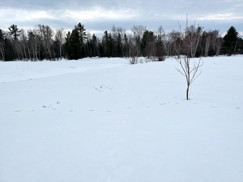


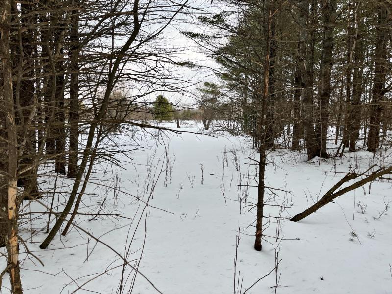

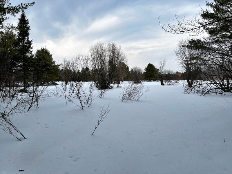


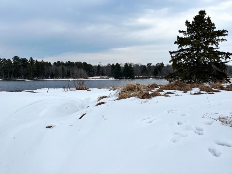
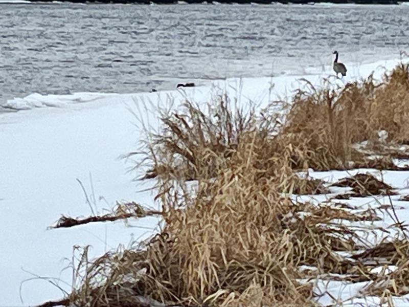

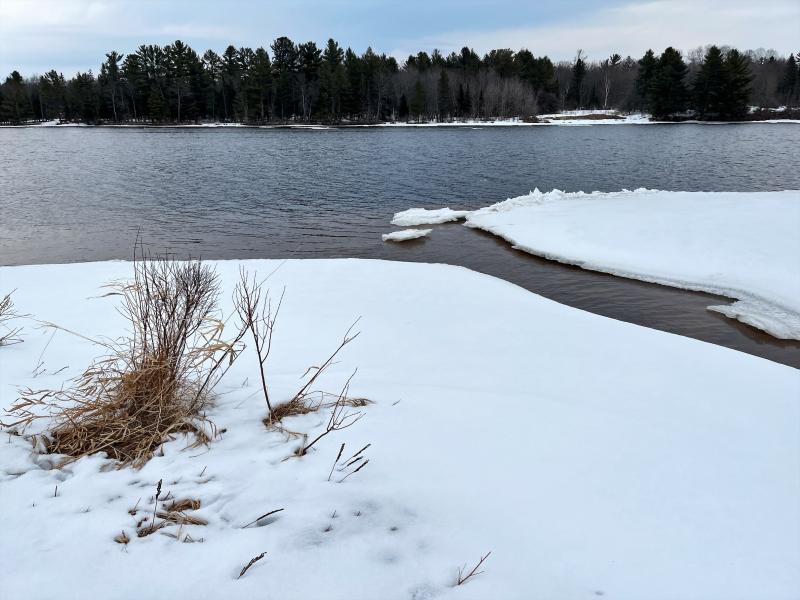

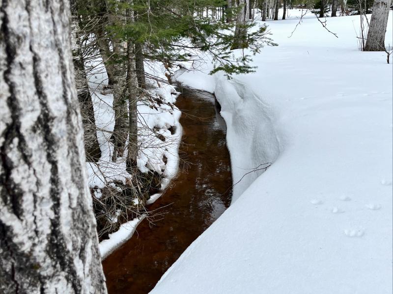


2 vacant lots off North Entry Road consisting of approximately 0.86 acres and 1.26 acres. The lots are heavily wooded and have a creek running through them that comes off the river.
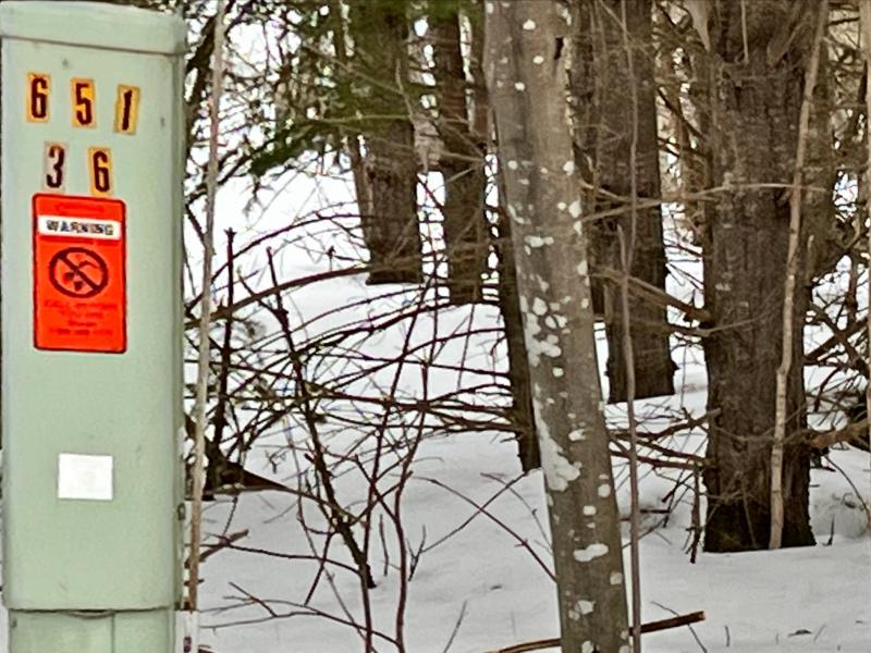
Parcel #s: 003-011-015-30 & 003-011-019-40
Firearms Prohibited
Members of the public attending the auction are prohibited from carrying/possessing a firearm(s) at the auction, even if carrying/possessing a firearm(s) is otherwise permitted under state or local law. The term “firearm” means any weapon (including a starter gun) which will or is designed to or may readily be converted to expel a projectile by the action of an explosive.
Asset Info
Under the authority in Internal Revenue Code section 6331, the property described below has been seized for nonpayment of internal revenue taxes due from Romana Starr, AKA Ramona Starr.
The property will be sold at public auction as provided by Internal Revenue Code section 6335 and related regulations.
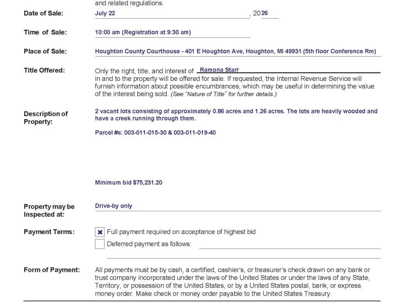
Date of Sale: July 22, 20 26
Time of Sale: 10:00 am (Registration at 9:30 am)
Place of Sale: Houghton County Courthouse - 401 E Houghton Ave, Houghton, MI 49931 (5th floor Conference Rm)
Description of Property:
2 vacant lots consisting of approximately 0.86 acres and 1.26 acres. The lots are heavily wooded and have a creek running through them.
Parcel #s: 003-011-015-30 & 003-011-019-40
Minimum bid $75,231.20
Title Offered: Only the right, title, and interest of Ramona Starr in and to the property will be offered for sale. If requested, the Internal Revenue Service will furnish information about possible encumbrances, which may be useful in determining the value of the interest being sold. (See “Nature of Title” for further details.)
Property may be Inspected by Drive-by only.
Payment Terms: Full payment required on acceptance of highest bid the day of the auction.
Form of Payment: All payments must be by cash, a certified, cashier’s, or treasurer’s check drawn on any bank or trust company incorporated under the laws of the United States or under the laws of any State, Territory, or possession of the United States, or by a United States postal, bank, or express money order. Make check or money order payable to the United States Treasury.
Parcel 003-011-015-30:
CH1-11-1C SEC 11 T53N R33W COM AT 1/4 COR COM TO SEC'S 11 & 14 TH N 0 DEG 15'41"E ON 1/4 LN 1266.83' TO POB: TH N 81 DEG 24'47"E 2472.64' TO MEND COR ON PORTAGE CHANNEL 70' FROM WATERS EDGE; TH N 41 DEG 02'39"W ON MEND LN 150' TH S 84 DEG 03'48"W 2357.99' TO C/L 238.43' TO POB; PARCEL EXT TO WATERS EDGE. SUBJECT TO 66' RD EASEMENT. CONT 10.01 A M/L AKA LOT C.
Parcel 003-011-019-40:
CH1-11-1D SEC 11 T53N R33W COM AT 1/4 COR COMM OF SEC'S 11 & 14; TH N 00 DEG 15' 41" E ON 1/4 LN 1046.96' TO POB: TH N 79 DEG 24' 20" E 2588.55' TO MEND COR 85' FRM WATERS EDGE; TH N 41 DEG 02' 39" W 2472.64' TO C/L SEC 11; TH S 0 DEG 15' 41" W 219.87' ON SD C/L TO POB: PAR EXT TO WATERS EDGE & SUB TO 66' RD EASEMENT. CONT 10.01 A M/L. AKA LOT D
A parcel of land located in the Southeast Quarter (SE¼) (the Southeast Quarter includes Government Lot Five (5)) of Section Eleven (11), Township Fifty-three North (T53N), Range Thirty-three West (R3JW), Michigan Meridian, Chassell Township, Houghton County, Michigan, and being mare particularly described as fallows,
Commencing at a 3/4-inch diameter iron pipe marking the one quarter corner common to Sections 11 and Fourteen (141, Township 53 North, Range 33 West, Michigan Meridian; then North 00° 15' 41" East (recorded as North 00° 16' 56" East) along the North and South one quarter line of said section 11, Township 53 North, Range 33 west, a distance of 1046.96 feet to a 5/8-inch rerod marking the Southwest corner and the point of beginning of the parcel hereby conveyed; then North 79° 24' 20" East a distance of 1101.14 feet to a 5/S-inch rerod marking the southwesterly line of a 66-foot County Road easement; then continuing North 79° 24' 20" East a distance of 86.09 feet to a 5/S-inch rerod marking the northeasterly line of said 66-faot road easement; then continuing North 79° 24' 20" East a distance of 1,401.32 feet to a 5/S-inch rerod on the meander line along Portage River, said point being 85 feet from the water's edge; then North 41° 02' 39" West along said meander line a distance of 150.00 feet to a 5/8-inch rerod marking the corner common to Parcel C and Parcel Din Grantors' Private Plat, said point being 70 feet from the water's edge; then continue North 41° 02' 39" West along said meander line a distance of 150 feet to a 5/8-inch rerod, said point
If you decide to withdraw your mail-in-bid prior to the sale, you must make notice of such in writing to the Property Appraisal & Liquidation Specialist (PALS) employee. The PALS must receive the written withdrawal prior to the subject sale. On a deferred payment sale, failure by the Bidder to pay any remaining balance due on the bid in accordance with the Notice of Public Auction Sale may result in the Bidder forfeiting the initial bid deposit.